Los Angeles has more streets than any other city in the US, 12,000 kilometers of roadway the surface of which covers about 15% of that of the entire cityscape. New bicycle lanes, reconfigured road diets, pedestrian advocacy, the rediscovery of public stairways, open streets events, and government programs like Great Streets have gone a long way in transforming the way Angelenos engage with one of our largest public assets. However, it's my belief that in nearly all things, what makes something great comes from the ground up and the streets are no exception.
*****
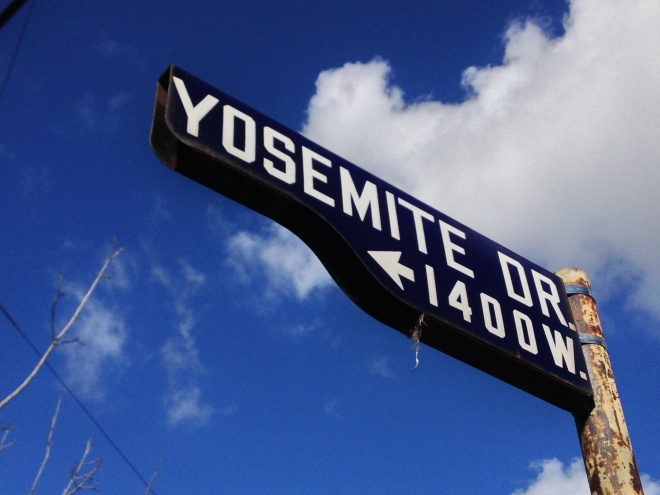
- Yosemite Drive street sign/bird house

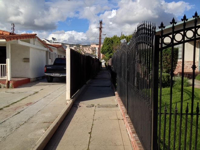
It probably wasn’t the first time that I drove or rode along Yosemite Drive but I have one amber-filtered memory of cruising along its gently meandering path one twilight and noting its charm; none of which owed anything to the presence of sidewalk jugglers, overpriced food trucks, or yarn-bombed lampposts. Yosemite's charms come from its graceful curves, the rustling leaves of the mature trees which line it, and the rolling hills which rising up steeply behind the small houses along its edges.


My first thought was that Yosemite Drive might've been developed along an old rail line since this is often the case with attractive, meandering, tree-lined roads but none of Los Angeles Railway’s yellow cars ever made their way through Yosemite Valley. They understandably forsook Yosemite Drive for Eagle Rock’s major streets: Colorado, Eagle Rock, and Figueroa — all of which are tellingly much wider than Yosemite. My next guess was that perhaps a river once ran along the bottom of this tiny valley and that turned out to be the case.


Much of this area was formerly covered with strawberry fields which replaced the sprawling pastures of the Verdugo family’s vast Rancho San Rafael. Although here too there were strawberries, a stream and a stately riparian woodland filled most of the valley floor between the Eagle Rock and York valleys. Yosemite Drive began life as Sycamore Avenue, a road which followed the course of Eagle Rock Creek, a stream which flowed from near the intersection of La Loma Road and Figueroa Street down valley to a confluence just east of Eagle Rock Boulevard, which then flowed into a wetland at a lower elevation.
The Eagle Rock Water Company was established in 1906 and they built a pump house at the corner of Maywood Avenue and Sycamore. Eagle Rock incorporated in 1911 with a population of about 600. That same year, Fred and Edith Ekhart (operators of the Gates Strawberry Ranch) built their home along Sycamore Avenue. Edith went on to found the Eagle Rock’s Friendly Club which later morphed into the Women’s Twentieth Century Club. The Eagle Rock Water Company was purchased in 1917 by the City of Eagle Rock. That year part of neighboring town of Annandale was annexed by Pasadena. The un-annexed portion of Annandale and the town of Eagle Rock were both annexed by Los Angeles in 1923 which resulted in renaming of numerous streets and Sycamore Avenue thus became Yosemite Drive.
In November of 1933, about 3,000 hectares of the Pickens Canyon in the San Gabriel Mountains went up in the smoke of a forest fire. On 31 December, 18.6 centimeters of rain fell on the denuded foothills which resulted in disastrous flooding which in turn lead to the death of about 100 people (45 of the missing were never accounted for). Woody Guthrie commemorated the calamity with his composition "The New Year's Flood." Eagle Rock Creek’s fate was to be tamed and entombed in a 2.5 meter storm drain which was lowered beneath Yosemite Drive.

Yosemite Drive is only about three kilometers long — not a major street by anyone’s measure, but because it runs between heavily traveled Figueroa Street and Eagle Rock Boulevard it’s unfortunately treated by too many motorists as some sort of freeway interchange. For such a small street, it’s especially disconcerting as cars speed by, rocking the cars parked along the road, and occasionally killing people as they try to shave a few seconds off of their commute. As many people died in the New Year's Flood die every year as the result of motorists running over pedestrians and along this stretch, whilst crossing a crosswalk, then-seven-year-old Alexander Sanna was struck by then-22-year-old Duc Quy Trinh who after colliding with the child, stopped and dislodged his body from the car, and then sped off -- only to turn himself in when guilt got the better of him. For his crimes of felony hit-and-run and misdemeanor vehicular manslaughter he was sentenced to three years imprisonment.
*****
I decided to start my walk at the Figueroa end of Yosemite and then walked west. At least one home was built in 1907 but most along Yosemite were built in the 1920s. Fewer were built during a second wave of development in the late 1940s. There are also a few larger developments which dramatically illustrate fairly different approaches to multi-family living.

- The Garden Apartments style Yosemite Gardens (1951)

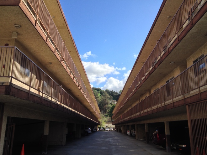
- Dingbat on steroids Yosemite Manor (1986)


- LEED certified Rock Row (2010 -- built by my next door neighbors the Kevin and Hardy Wronske)

ROCKDALE ELEMENTARY


Rockdale Elementary School was established in 1886 in the Annandale School District. In 1928, an attractive red brick schoolhouse was constructed. The San Fernando Earthquake in 1971 rendered the school unsafe and after its demolition, the current school was built.
SILVERWOOD’S HAPPYLAND

- The cheery, tiled planters at Happyland's main intersection

The land along Yosemite Drive was subdivided into several small tracts including the Blackmer, C.S. James, Douglas, Floristan Heights, Gates, Hamilton Place, J.Q. Adams, Marble Heights, Myers and Kulli Sycamore Glen, Myers and Kulli’s Oak Grove, and Pottawattamie Park tracts but my favorite is the ridiculously named Silverwood’s Happyland subdivision, developed in the 1920s. The Silverwood in question was a Los Angeles clothier named Francis B. Silverwood who also wrote the lyrics for “I Love You California” in 1913.

- Bilo Market


- R.O.C.K. Teen Center


- The Eagles lodge

Primarily residential, Happyland is noteworthy for its mix of period colonial revival architecture styles and its small commercial center at the intersection of Yosemite Drive and Townsend which is still home to a small cluster of businesses including Bilo Market (building constructed by PC Blackmer in 1925), R.O.C.K. Teen Center (and coffee house), and a Fraternal Order of the Eagles lodge (which was having Wild Game BBQ Night).
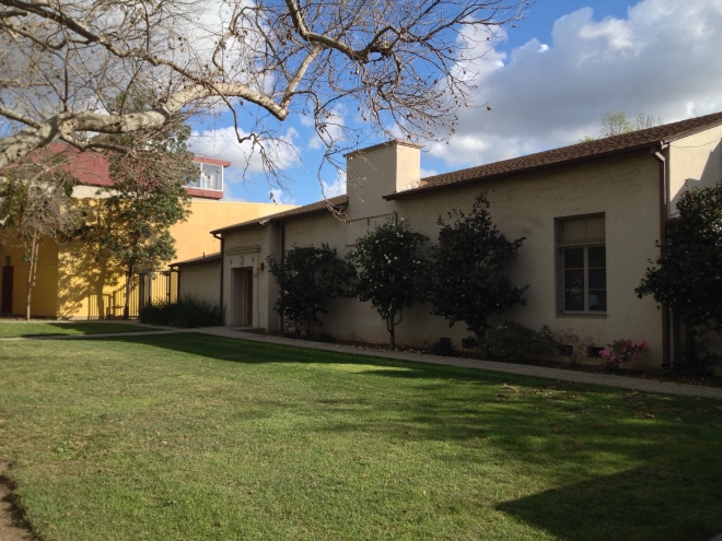
COMMUNITY CHURCH OF EAGLE ROCK

- Community Church of Eagle Rock

The Community Church of Eagle Rock (or Eagle Rock Community Church) was dedicated in 1927. In 1936 it became the Eagle Rock Community Covenant Church. Today it’s known as Iglesia Del Pacto Evangélico.
EAGLE ROCK HIGH SCHOOL
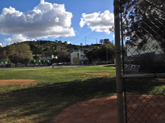
- Eagle Rock High School

The original schoolhouse of Eagle Rock High School was built in 1927 to serve a student population of just 690. Most of the buildings today seem to have been built in the late 1960s or early '70s. The discarded Kool-Aid pouches and juice boxes looked rather more recent.
YOSEMITE RECREATION CENTER
- Yosemite Recreation Center

The grounds of Yosemite Recreation Center include two auditoriums, a playground, handball courts, an indoor gym, an outdoor gym, tennis courts, and outdoor pool, and basketball courts -- the lagger of which seemed to be getting the most use.
DELORES WALK

Delrosa Walk is a short walkway connecting Yosemite Drive to Addison Way, a street which runs parallel a block to the south. Although so inconspicuous that I at first passed it without notice, once I successfully located it I was somewhat surprised to see this minor pedestrian artery being used by two women.
- Delrosa Walk

DISTRIBUTING STATION NO. 30

- Distributing Station No. 30

The art deco Distributing Station No. 30 was built in 1936 at the intersection that had originally been home to Eagle Rock Water Company’s pump.

Although I prefer the quiet intersection of Yosemite and Townsend, the main commercial hub of the street is its intersection with Eagle Rock Boulevard. Nearby is Abby’s Diner, Eagle Rock Barber Shop, the Eagle Rock Church of the Nazarene, the Eagle Rock Music Studio, Ballroom Blitz, New Century Glass, Tattoo Love, Transport Skate Shop, and a nameless shopping center that’s home to Pot Thai Cafe, Mediterranean Triangle, Cabo Joe’s Mexican Grill, Fresh Donut House, Video Hut, and several chain restaurants and shops, and the former Yosemite Theatre.
YOSEMITE THEATRE
On 3 May, 1929, the Kenneth A. Gordon-designed, 900-seat, Yosemite Theatre opened at 4884 Eagle Rock Boulevard. It featured a couple of nights of vaudeville performances before the screening of its first film, The Younger Generation. In 1937 its name was changed to the New Eagle Theatre and, no longer new even in name, it simply became the Eagle Theatre in 1940. From 1976 till 1979 it screened porn as part of the Pussycat chain. It became a budget independent theater in 1983 and closed permanently in 2001 to, like many former theaters, become a church -- in this case, the Cenacle of Faith.

- Plenty of parking and little traffic so just park wherever


- Looking east down Yosemite Drive


- The western end of Yosemite

West of Eagle Rock Boulevard, Yosemite Drive begins its steep ascent into the hills. The sidewalks eventually vanish but so does most of the traffic, so walking in the street feels less dangerous. The views from this hill are pretty impressive and off in the distance I could make out the shadow and shape of the titular Eagle Rock.

- Fair Park Avenue cul-de-sac and the Eagle Rock in the distance

Located just below the western end of Yosemite Drive is Fair Park Avenue, a short street and cul-de-sac with about nine lots and for some reason, no houses.
SWANSON HOUSE
- Swanson House (1921)

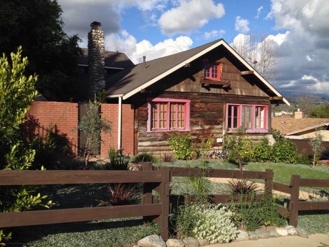
On the other side of Yosemite Drive is Addison Way, which I visited to check out the historic Swanson House, located as it is at 2373 Addison Way. It was built by the owner of the Eagle Rock Lumber Company, Emil Swanson, and naturally is a log cabin.
*****

If you don't have the time or ability to walk, Yosemite Drive is well-served by buses, including Metro’s 28, 81, 83, and 180/181 lines as well as the LADOT's DASH Highland Park/Eagle Rock line. There are things that you will miss, however, from a bus or car; the smell of orange blossoms, the song of the robin, the jungle-like container gardens, the mentions of ZZ Top and Ford Motor Company along the sidewalks. To quote Ferris Bueller, who ironically was complaining about not having a car, “Life moves pretty fast. If you don't stop and look around once in a while, you could miss it.”
Thanks to Jane Tsong (of Myriad Small Things), Will Campbell at Blogging LA, Eric H. Warren and Frank F. Parrello’s Pioneers of Eagle Rock, Walk Eagle Rock, LA Creek Freak, and Eric H. Warren’s Eagle Rock.
*****
Eric Brightwell is an adventurer, writer, rambler, explorer, cartographer, and guerrilla gardener who is always seeking writing, speaking, traveling, and art opportunities. He is not interested in writing advertorials, clickbait, or listicles and jobs must pay more than slave wages as he would rather write for pleasure than for peanuts. Brightwell’s written work has appeared in Amoeblog, diaCRITICS, and KCET Departures. His work has been featured by the American Institute of Architects, the Architecture & Design Museum, the Craft & Folk Art Museum, Form Follows Function, Los Angeles County Store, Skid Row Housing Trust, and 1650 Gallery. Brightwell has been featured in the Los Angeles Times, Huffington Post, Los Angeles Magazine, LAist, Eastsider LA, Boing Boing, Los Angeles, I’m Yours, and on Notebook on Cities and Culture. He has been a guest speaker on KCRW‘s Which Way, LA? and at Emerson College. Art prints of his maps are available from 1650 Gallery and on other products from Cal31. He is currently writing a book about Los Angeles and you can follow him on Facebook, Instagram, and Twitter.
No comments:
Post a Comment