- Wetlands

Most of Los Angeles's climate is chaparral, similar to that of Mexico's Baja California, central Chile, southwestern South Africa, parts of southwestern Australia, and most of the Mediterranean Coast. In chaparral climates, most summers are rather dry and the rainy season occurs primarily between late autumn and early spring.
The Los Angeles Basin and surrounding valley floors are fed by mountain springs, streams and rivers which formerly fed a vast network of alkali meadows, brackish ponds, lagoons, marshes, soda lakes, swamps, and other wetlands. After 1848, when California became part of the US, the American conquerors often viewed wetlands with disdain -- unsuitable for development and therefore primarily utilized as dumps or later converted into reservoirs. After a series of deadly floods in the 1930s, most of the streams and rivers of the Southland were entombed in concrete channels.
- Artificial Wetlands

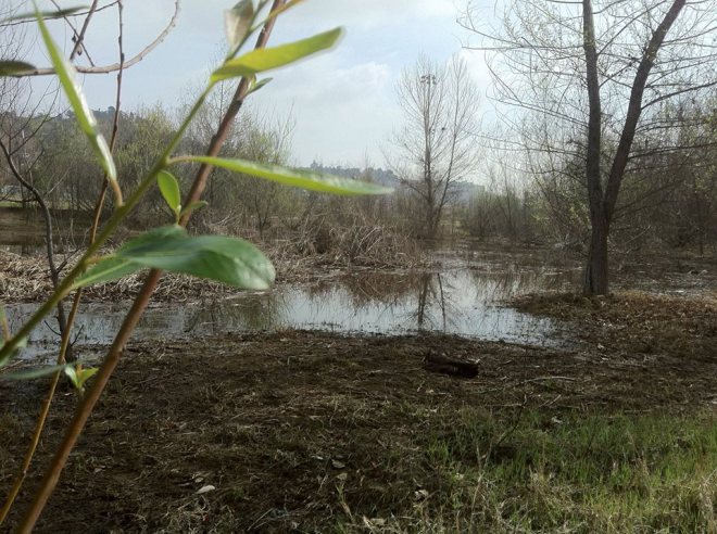
Today more than 95% of Southern California’s wetlands have been lost due to human development – the largest loss of any region in the nation. However, in recent years many Southern California rivers and streams have begun to undergo restoration and revitalization and in the course of my rambles I find myself with increasing regularity stumbling across "artificial" wetlands designed to mimic their naturally occurring counterparts. All urban oases of tranquility and wildlife exude on me a particular appeal throughout the year but they're really wonderful it times like these when we’re blessed with both heavy rainfall and copious sunshine. With that in mind, here is my guide to the wetlands of the Southland (which I hope to add to).
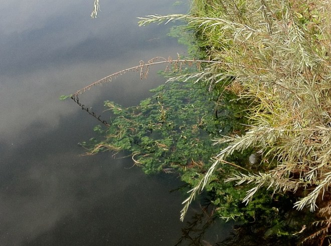
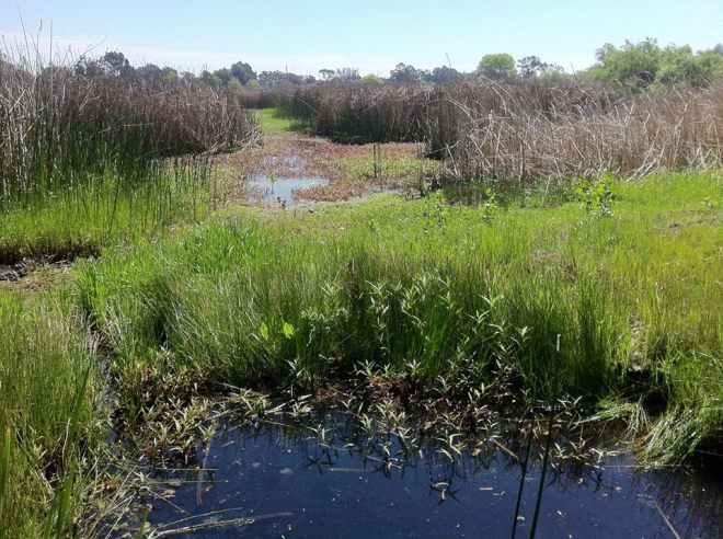
- Soggy Wetlands

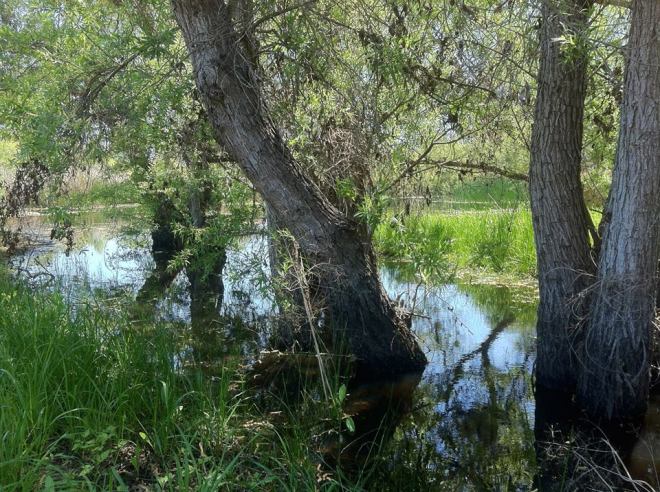
*****
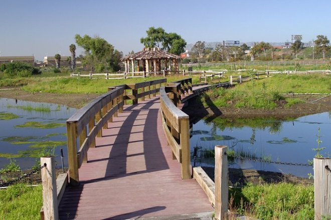
BALLONA WETLANDS
- Ballona Wetlands


- Ballona Wetlands


- Ballona Creek and homeless encampment

The Ballona Wetlands (in Los Angeles's Del Rey neighborhood) were once part of an 800 hectare expanse of marshes, mud flats, salt pans, and sand dunes that stretched from the shores of Santa Monica Bay to the Baldwin Hills in the east. Today only 240 hectares of them remain. The once wild Ballona Creek is channelized and invasive plants have crowded out most of the natives. Although officially off-limits to the public, due to the appalling lack of sidewalks or even shoulders along Culver and Jefferson Boulevard, I was unfortunately forced to walk through the Ballona Wetlands Ecological Reserve. In doing so I discovered considerable evidence of human presence in the form of encampments, dumps, and litter. In 2003, the state acquired the reserve from private landowners today a public-private partnership and is in the process of restoring the habitat which will make visiting them a much more rewarding experience.
The Ballona Wetlands are accessed by the 3 Line of Santa Monica's Big Blue Bus.
BIXBY MARSHLAND
- Bixby Marshlands (credit: Sanitation Districts of Los Angeles County)

In 2009, the Sanitation Districts of Los Angeles County completed their restoration of the Bixby Marshland (in Carson), part of the districts' largest wastewater treatment facility (the Water Pollution Control Plant) and a remnant of the formerly-vast Bixby Slough wetland. The seven hectare wetlands are open the first Saturday of the month from 8 am until noon and docents are available to provide tours, which may also be scheduled by appointment. I haven't been inside yet although I did try (and fail) to grab a stray chihuahua who escaped by running into the marshlands.
The Bixby Marshlands are accessible via Torrance Transit's 7 Line.
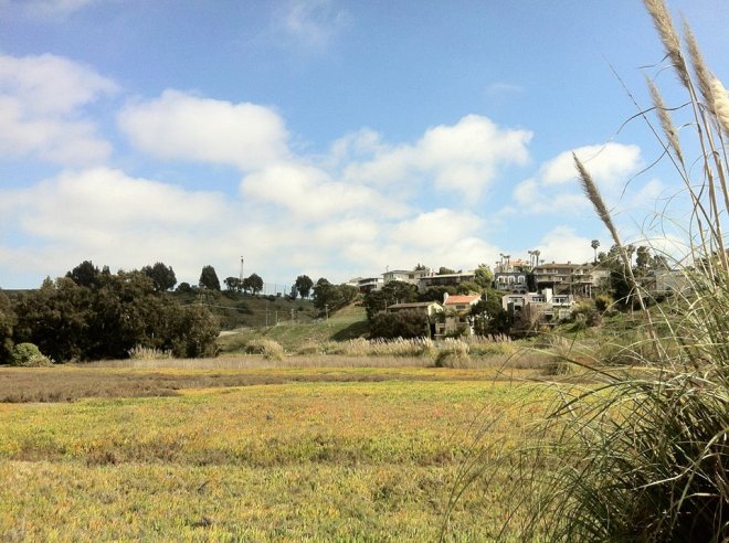
BOLSA CHICA ECOLOGICAL RESERVE

- Bolsa Chica Wetlands

- California Sea Hares
The 490 hectare Bolsa Chica Ecological Reserve (in Huntington Beach) were established by the California Department of Fish and Game in 1979. The first time I visited was with my friend Bao and on that occasion we found it to be popular with birders drawn by the presence of California gnatcatchers, Caspian terns, double-crested cormorants, great blue herons, great horned owls, least terns, light-footed rails, red-tailed hawks, savannah sparrows, snowy egrets, and snowy plovers (among other species). I’ve been back a few times since but only on the first visit did I spy sea hares slowly scooting across the floors of the shallow pools. Free public tours are offered each month by three organizations: The first Saturday at 9 am (by Amigos de Bolsa Chica), second Saturday at 10 am (by Bolsa Chica Conservancy), and the third Sunday at 10 am (by Bolsa Chica Land Trust). It's open seven days a week from 9 am till 4 pm.
Bolsa Chica Ecological Reserve is accessible via OCTA's 1 Line.
COLORADO LAGOON

- Colorado Lagoon (credit: Long Beach Natural Areas)
Colorado Lagoon is located along an inward arm of Alamitos Bay in the city of Long Beach. The 5 hectare coastal salt marsh is a remnant of the once massive Los Cerritos Wetlands. The park in which the lagoon is located is also home of the Wetland & Marine Science Education Center. Its restoration, underway, is being managed by Friends of Colorado Lagoon.
Colorado Lagoon is accessible via Long Beach Transit's 151 Line.
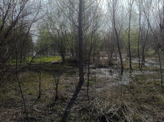
DE FOREST WETLANDS
The DeForest Wetlands Restoration Project (in Long Beach's De Forest neighborhood) is part of the larger Lower Los Angeles River Parkway Plan to revitalize the lower Los Angeles River. Still in process, when completed the project will have transformed fourteen hectares of land into public park space and wetlands. When I visited this past spring, there wasn't yet much to see.
The DeForest Wetlands will be accessible via Long Beach Transit's 51, 52, 191, and 192 Lines.
DEL REY LAGOON PARK
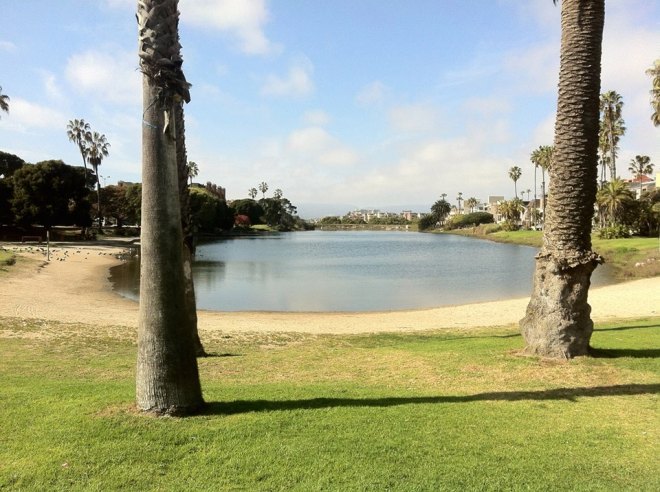
- Del Rey Lagoon

- Del Rey Lagoon

Del Rey Lagoon Park (in Los Angeles's Playa del Rey neighborhood) is an unstaffed pocket park open from dawn to dusk and managed by the City of Los Angeles Department of Parks & Recreation. It's located at the edge of Ballona Creek and Santa Monica Bay. Though small, the park has a basketball court and a baseball diamond. The lagoon itself -- at least when I visited -- was host only to seagulls and pigeons which is why I assume there were no birders.
Del Rey Lagoon Park is accessible via Metro's 115 Line.
DOMINGUEZ GAP WETLANDS
- Dominguez Gap Wetlands

- Dominguez Gap Wetlands

The 21-acre Dominguez Gap Wetlands Project (in Long Beach's Sutter and Los Cerritos neighborhoods) was the first (of five) completed demonstration projects of the Los Angeles River Master Plan. It includes treatment wetlands at the convergence of Compton Creek and the Los Angeles River -- as well as trails and two bird observation decks.
The Dominguez Gap Wetlands are accessible via Long Beach Transit's 191 and 192 Lines.
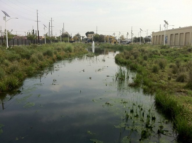
JAN PERRY WETLANDS
- South L.A. Wetlands Park

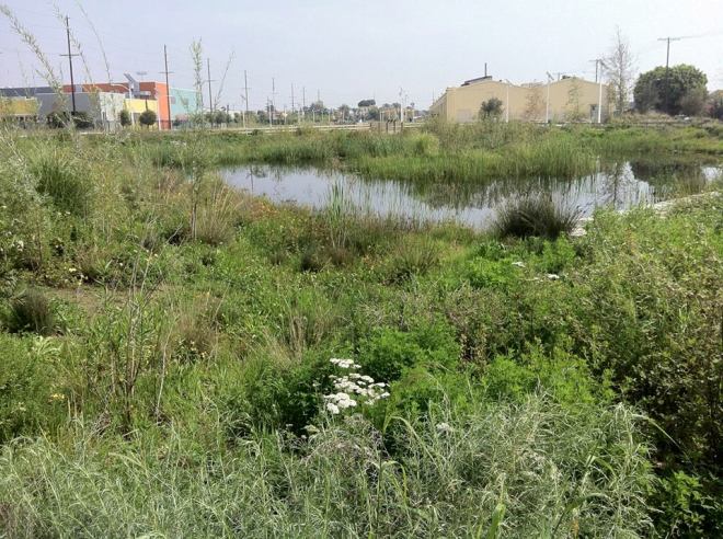
- Jan Perry Wetlands

The small, almost 2 hectare Jan Perry Wetlands (formerly known as South Los Angeles Wetlands Park) opened in 2012 in the South Park neighborhood on the site of a former bus and rail yard. The wetlands are densely-landscaped with native plants and groomed trails and although primarily functional in nature (capable of filtering 2500 liters of runoff a day), the wetlands are more attractive than many proper parks in the area (although Central-Alameda's nearby Augustus F. Hawkins Nature Park is worth checking out).
The Jan Perry Wetlands are accessible via Metro's 51/52/352 Line and LA DOT's DASH Southeast Line.
LOS CERRITOS WETLANDS

- Steam Shovel Slough, Los Cerritos Wetlands, Studebaker Rd & power plant in the background (credit: CA Open Space)
There are about 300 hectares left of coastal wetlands near the mouth of the San Gabriel River, straddling Long Beach's Marina neighborhood and city of Seal Beach. The Los Cerritos Wetlands Authority (LCWA) currently owns about 70 hectares of the wetlands and are in the process of restoring them and hopefully acquiring more. The LCWA host guided nature walks on first Saturdays from 8 am to 10 am and the El Dorado Audubon Society occasionally host occasional bird walks as well, offering participants the chance to see endangered Belding’s Savannah Sparrows, California Least Terns, and California Brown Pelicans, amongst other species of bird, butterfly, and more.
Los Cerritos Wetlands are accessible via OCTA 1 Line and Long Beach Transit's 131 and 171 Lines.
MADRONA MARSH
- Madrona Marsh

- Madrona Marsh

- Madrona Marsh

- Madrona Marsh

The Madrona Marsh Preserve is last remnant of a once vast vernal marsh in the South Bay, located in the city of Torrance beneath the hills of Palos Verdes Peninsula. The preserve and neighboring Madrona Marsh Nature Center are operated by the Friends of Madrona Marsh. The marsh and nature center are open Tuesday through Sunday from 10 am - 5 pm. It’s one of my absolute favorite wetlands, which I first became aware of when it was visited by the late, great Huell Howser on episode 114 of his series, California’s Golden Parks.
Madrona Marsh Preserve is accessible via Torrance Transit's 7 Line.
MALIBU LAGOON

- Malibu Lagoon (credit: Malibu Lagoon Restoration Project)

Malibu Lagoon is located in the city of Malibu where Malibu Creek meets the Pacific. Nearby are the Malibu Pier and Surfrider Beach, and the historic Adamson House -- a Spanish Colonial Revival style former residence designed by Stiles O. Clements and built in 1929. The park is also home of the Malibu Lagoon Museum. The lagoon itself is currently undergoing restoration as part of the Malibu Lagoon Restoration Project.
Malibu Lagoon is accessible via Metro's 534 Line.
PIUTE PONDS

- Piute Ponds (credit: Dr. Callyn Yorke)

The Piute Ponds are largest remaining freshwater wetlands in Los Angeles County and are located in, of all places, the only part of Los Angeles that is true desert, the Antelope Valley. The ponds are an important resting ground for over 250 species of migratory birds, are contained within the 3900 hectare Harley Berhow Recreational Area which is located about ten kilometers north of Lancaster. The wetlands are open to the public with possession of a special access letter.
The Piute Ponds are fairly remote. Walking from Lancaster Station will take over two hours and the average cyclist will take about half an hour.
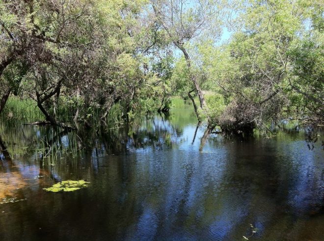
RIO DE LOS ANGELES WETLANDS

- Rio de Los Angeles Wetlands

- Rio de Los Angeles Wetlands

- Rio de Los Angeles Wetlands

Rio de Los Angeles State Park was created on the site of an old rail yard (Taylor Yard) in Los Angeles's Glassell Park neighborhood. The 24 hectare park includes a 1.5 hectare wetlands, The Rio de Los Angeles Wetlands. The "artificial" wetlands are managed by the Department of Parks & Recreation and maintained by North East Trees. Whilst the park includes a popular playground and soccer field, the wetlands to their west feel more isolated than they actually are.
The Rio de Los Angeles Wetlands are accessible via Metro's 28, 90/91, and 94 Lines.
SAN JOAQUIN MARSH & WILDLIFE SANCTUARY
- San Joaquin Wildlife Sanctuary (credit: Sea and Sage Audubon Society)

The San Joaquin Marsh & Wildlife Sanctuary is a coastal marsh of over 120 hectares located along the banks of San Diego Creek in the city of Irvine. The wetlands, managed by by the Irvine Water Ranch District, include 20 kilometers of trails and are home to over 200 bird species. Santa Ana's Discovery Science Center and the National Audubon Society offer tours and educational programs but the wetlands are open to all from dawn until dusk, seven days a week.
The San Joaquin Marsh & Wildlife Sanctuary is accessible via Irvine's iShuttle Route B and OCTA's 59, 178, 212, 213, and 473 Lines.
TOPANGA LAGOON

- Topanga Lagoon (credit: Rosi Dagit)
The Topanga Lagoon is located in the unincorporated community of Topanga's Topanga State Park. The .7 hectare lagoon is the remnant of a much larger wetland formed at the mouth of Topanga Creek. Restoration of the lagoon is currently in the planning phase.
Topanga Lagoon is accessible via Metro's 534 Line.
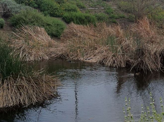
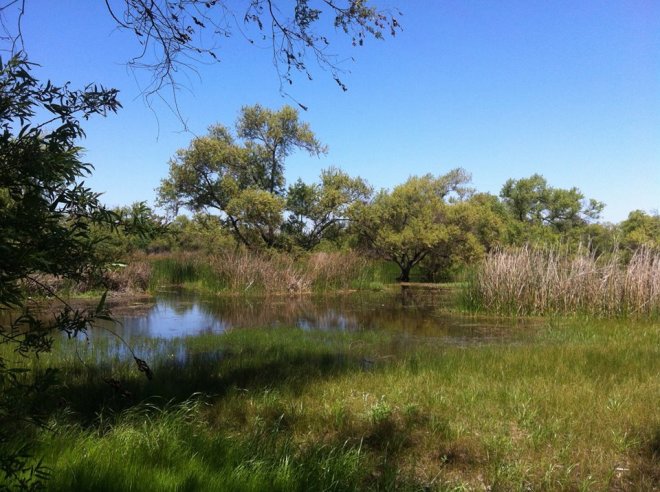
*****
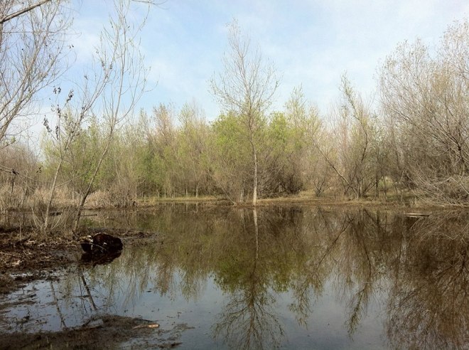
- Lovely Wetlands

As always, additions and corrections are welcome. Hang your teru teru bōzu upside down, stay dry, and don't look at the candles of corpses!
*****
Eric Brightwell is a writer, rambler, explorer, cartographer, and guerrilla gardener who is always seeking writing, speaking, traveling, and art opportunities; however, job offers must pay more than slave wages and involve neither listicles nor television personalities. Brightwell’s written work has appeared in Amoeblog, diaCRITICS, and KCET Departures. His art has been featured by the American Institute of Architects, theArchitecture & Design Museum, the Craft & Folk Art Museum, and 1650 Gallery. Art prints of his maps are available from 1650 Gallery and on other products from Cal31. Brightwell has been featured as subject in theLos Angeles Times, Huffington Post, and Notebook on Cities and Culture. He has been a guest speaker onKCRW‘s Which Way, LA? and at Emerson College. He is currently writing a book about Los Angeles and you can follow him on Facebook, Instagram, and Twitter.
No comments:
Post a Comment